INUIT GUIDE RESEARCH TO LOW IMPACT SHIPPING CORRIDORS

“We have to hunt to eat, and these days that’s getting harder”.
That message from Arden Nibgoarsi was one that researchers heard repeatedly when they visited five coastal communities to learn how a dramatic increase in Arctic shipping is affecting their food security and way of life.
“We are seeing many more ships coming into and out of our area and they seem to go wherever they choose. The noise is making marine animals flee certain areas which means we have to go further to hunt. It’s very concerning to the elders and hunters here. Buying food from a store is very expensive and not always available”, says Nibgoarsi, who lives in Arviat, Nunavut on the northwest coast of Hudson Bay.
Nibgoarsi is one of several Inuit who contributed to a project studying the safety and sustainability of northern shipping corridors, with funding from the Marine Environmental Observation Prediction and Response (MEOPAR) Network and Irving Shipbuilding Inc.
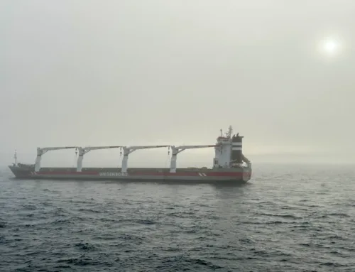
Rapidly shrinking sea ice and changing socio-economic factors have attracted more than double the number of ships over the past three decades to this remote yet increasingly accessible region. Several countries have already begun preparing for the inevitable opening of new Arctic marine corridors, notably the elusive Northwest Passage, and the risks and opportunities that will bring for natural resource development and trade. Discussions have also begun on how Canada’s marine corridors could be integrated with those of the United States and Russia.
But this reality is also testing Canada’s safety and security, and challenging northern communities that rely on the marine environment for their food, transportation and way of life. In response, the Canadian Coast Guard, the Canadian Hydrographic Service and Transport Canada ![]() partnered with MEOPAR and the University of Ottawa to conduct research in northern communities to identify ecologically and culturally significant marine areas.
partnered with MEOPAR and the University of Ottawa to conduct research in northern communities to identify ecologically and culturally significant marine areas.
“Our goal is to create very pragmatic information for policymakers and local communities that will influence the positioning and management of marine corridors. The Canadian Hydrographic Service is also interested in using data from the project to implement a digital mapping program where they can relay this type of information directly to ships,” says lead researcher Dr. Jackie Dawson, a Canada Research Chair in Environment, Society and Policy at the University of Ottawa. Dr. Dawson’s research group also created a ship track database to better understand historical shipping trends across the region (dating back to 1990).
The findings will be integrated into the Low Impact Shipping Corridors Initiative (formerly known as the Northern Marine Transportation Corridors Initiative), a Government of Canada initiative to pinpoint specific shipping routes throughout the Arctic, and prioritize spending for infrastructure and services for transportation and emergency response (e.g. hydrography, navigational aids, ice breaking, patrolling). Data from the project will be available to Inuit organizations to establish management plans for land claim areas, manage local resources, and negotiate Inuit Impact Benefit Agreements with companies that want to work in the region.
“It’s really tricky to place these corridors in a way that will create the least amount of impact for ecological systems and local people and cultural use, including local marine use areas and harvesting areas,” says Dawson. “So it’s important that we understand how to manage Arctic shipping in a way that respects local people, supports industry development, and encourages economic growth in a sustainable way.”
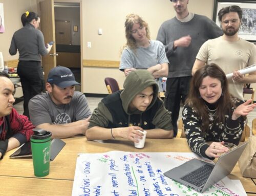
Inuit participation is key – the project’s tagline is “infusing Inuit voices into federal policy of shipping”. In addition to working with the Nunavut government, Inuit organizations, local councils and Inuit Tapiriit Kanatami, Dawson’s team hired about 15 local residents to co-facilitate community workshops. Natalie Carter, a Postdoctoral Fellow on the project team, also trained 25 Inuit youth (ages 18 to 30) on mapping techniques – skills that could lead to future jobs in monitoring and mapping projects.
Hamlet councillor Eleanore Arreak-Pitseolak was one of the youth involved with the consultations in Pond Inlet, Nunavut. Located on the north shore of Baffin Island, this small community of just 1,600 people is seeing a spike in marine traffic from cruise ships and private yachts, as well as vessels transporting iron ore from the Mary River mine.
The concerns raised in Pond Inlet echoed those heard in other coastal communities. Noisy ships frightening away belugas and other sea mammals are a big issue, as are ships that discharge ballast water, which could introduce invasive species into the region.
“The elders and the hunters know where the animals travel so they are the best ones to provide input on where the ship routes should go, where they shouldn’t and where they should slow down,” says Arreak-Pitseolak. “We need to have the ships all using the same routes. This was the biggest concern we heard.”
“This project is important for ensuring that our community has a say in the governance of these corridors and where they will be,” says Natasha Simonee, a project community facilitator in Pond Inlet. “25 of the 26 communities in Nunavut are coastal and we rely on these waters 365 days a year for travel and marine life for our food. These corridors are like building a road through my farm, and you wouldn’t think of doing that anywhere else in Canada without first asking where you should build that road.”
Why MEOPAR?
“This kind of research project is really hard to fund because it’s interdisciplinary. In putting together the ship track database, for example, we needed experts who know about sea ice, satellite imagery and advanced mathematics. We also needed social scientists with skills in working with Inuit communities,” explains Dawson. “The beauty of MEOPAR and the NCE program is it’s very focused on knowledge translation and outreach.”
As a national NCE, MEOPAR is also able to recruit expertise from across Canada. “This project is focused on how to do safe and sustainable shipping in the north, and the different scientific disciplines and stakeholders are scattered across the country,” says Dr. Doug Wallace, Scientific Director at MEOPAR. “Each one has a piece of the puzzle and the NCE makes it possible to bring all these pieces together to solve challenges that need pragmatic solutions.”
“When MEOPAR launched we had this mantra of the 3 ‘Ms’,” adds Wallace. “We wanted our projects to be multidisciplinary, multi-sectoral and multi-purpose… and what we do is getting noticed internationally. We were invited to a ministerial summit last year (2016) on US-Canadian policy on the north because of this breadth of engagement we have focusing on climate-related research, but also community adaptation and community preparedness in the north.”
Neil O’Rourke, the director of integrated logistic support for the Canadian Coast Guard, summed up the project’s value in an April 2016 interview with CBC. “At the end of the day, this is about enhancing services to Northern communities and making sure Canada is prepared for international traffic through the Northwest Passage. We want to make sure we minimize any disruption to those communities and their established ways of life, and we want to make sure we minimize any disruption to the environment.”
Wallace adds that the project would not have been possible without support from Irving Shipbuilding. The company is investing a total of $1 million in nine MEOPAR projects related to developing and applying new technology or approaches to advance environmental observation, safe operations, and/or emergency response measures on Canada’s coasts and oceans.
“Ensuring Canada has a sustainable and vibrant marine industry is a priority for Irving Shipbuilding under the National Shipbuilding Procurement Strategy,” said Kevin McCoy, president of Irving Shipbuilding. “We are proud to work with MEOPAR to support leading edge research across the country that can help achieve this goal.”
Call out: MEOPAR received $28.5 million as part of the most recent NCE program competition, announced in March 2017.
Partners/Stakeholders:
- Fisheries and Oceans Canada – Canadian Coast Guard
- Environment and Climate Change Canada – Canadian Ice Service
- Transport Canada
- Oceans North Canada
- Inuit Tapiriit Kanatami (Canada’s National Inuit Organization)
- World Wildlife Fund (WWF)
- Nunavut General Monitoring Program
- Nunavut Research Institute
- Irving Shipbuilding
- exactEarth Inc.
- Mittimatalik Hunters and Trappers Organization – Pond Inlet
- Arviat Wellness Centre – Arviat
- Ikaarvik Barriers:Bridges Program
- Ekaluktiak Hunters & Trappers Organization
- Students for Canada’s North
- Ulukhaktok Community Corporation – Ulukhaktok
- Olokhaktomiut Hunters & Trappers Committee – Ulukahktok

